| |

|
 |
Maps of Jacksonville to Bahamas
Read more 
|
|
 |
| |

|
|
Pre Programmed Card Includes: Mapping Coverage of Les Mechins to St. Georges Bay - For: GPSMAP 4XXX, 5X5, 5x0 and 4X0 Series
Read more
|
|
|
| |

|
|
Pre Programmed Card Includes: Mapping Coverage of Newfoundland West - For: GPSMAP 4XXX, 5X5, 5x0 and 4X0 Series
Read more
|
|
|
| |
|
|
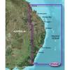
Card Includes: Mapping Software of East Coast Austrailia
Read more
|
|
|
| |

|
|
Maps of Southwest Caribbean
Read more
|
|
|
| |

|
|
Card Includes: Detailed Mapping Software of Wrangell to Glacier Bay, Sitka and Juneau
Read more
|
|
|
| |
|
|
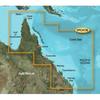
vpc413s covers:detailed coverage of the northeastern coast of australia from mornington island to hervey bay. also includes detailed coverage of cape york cairns townsville mackay and the great barrier reef.bluechart g2 visionwhat is bluechart
Read more
|
|
|
| |
|
|
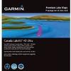
Our Canada LakeVü HD and Canada LakeVü HD Ultra products feature over 13, 500 lakes with detailed depth information. Includes provinces of Alberta, British Columbia, Nova Scotia, Ontario, Quebec, Saskatchewan, and Yukon provinces. It also includes...
Read more
|
|
|
| |

|
|
Compatible with: Garmin Quest, Garmin StreetPilot
Read more
|
|
|
| |

|
|
VUS517L Covers:Detailed coverage of Alaska, from Prince of Wales Island to Point Lay on the North Slope, including Glacier Bay, the Kenai Peninsula, and the Aleutian Chain in full. Bathymetric coverage of the Gulf of Alaska, Bristol Bay and United...
Read more
|
|
|
| |

|
|
Card Includes: Detailed Mapping Software of Gulf of Mexico from Brownsville, TX to Plantation Key, FL including Corpus Christi, TX, Matagorda Bay, Galveston Bay, Port Arthur, TX, Atchafalaya Bay, the Mississippi Delta, Chandeleur Islands, Tampa Bay and th
Read more
|
|
|
| |

|
|
Card Includes: Detailed Mapping Software of Atchafalaya Bay to Brownsville, including Port Arthur, Galveston Bay, Matagorda Bay, and Padre Island
Read more
|
|
|


 Switch to grid view