| |
|
 |
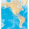
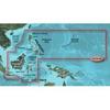
This chart covers: ST LAWRENCE RIVER, GULF OF ST LAWRENCE, NOVA SCOTIA, LAKE CHAMPLAIN From Cornwall and Montebello to Bay of Fundy, including Sable Island, Iles De La Madeleine, Prince Edward Island, Anticosti Island and Lake George. Platinum+ Multi-Dime
Read more 
|
|
 |
| |

|
|
Navionics 916P-2 Platinum Plus NW ALEUTIAN ISLANDS, WESTERN ALASKA, NORTHERN ALASKA From Shumagin Islands to Demarcation Bay, including Dutch Harbor and the Pribilof Islands. Compatibility Guide
Read more
|
|
|
| |

|
|
Garmin B744VL Long Stem Bronze Thru-Hull Depth/Temp/Speed with FB - 8 Pin
Read more
|
|
|
| |
|
|
On SD Memory Card BlueChart g2 Vision offers the same rich detailed charting of BlueChart g2 to help you get the most out of your unit. In addition, g2 Vision features a growing database of high-resolution satellite imagery, above and below the water 3D p
Read more
|
|
|
| |
|
|
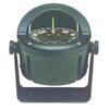
Ritchie Navigation Helmsman Compasses Bracket Mount Compass, 3 3/4inch Powerdamp Flat Dial, Black . Big compass performance and style that fits today s most popular boats, Helmsman compasses feature high-impact, fiberglass-reinforced components with a mat
Read more
|
|
|
| |
|
|
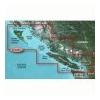
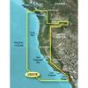
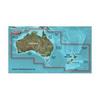
Detailed coverage of the West coast of North America from Vancouver, Can. to the U.S. border with Mexico. Detailed coverage includes Puget Sound, San Francisco Bay, San Diego Harbor, the Columbia and Snake Rivers, and the California Delta to Sacramento an
Read more
|
|
|
| |

|
|
The MotorGuide X3 Saltwater Bow-Mount Trolling Motor offers 55 lb. of thrust and features a dual-cable, pull-pull steering system.
Read more
|
|
|
| |
|
|
VAE005R Covers: General coverage of the coasts of the Philippines, portions of Indonesia, including Java, and Malaysia located to the east of Singapore and west of Halmahera Island, and portions of East Timor. Included in this overall general coverage are
Read more
|
|
|
| |

|
|
Axiom is expandable, so its capabilities can grow, as needed. Add multiple Axiom displays or select from the full range of Raymarine accessories, including Quantum radar, CHIRP Sonar, FLIR thermal cameras, audio integration, instruments, cameras, and...
Read more
|
|
|
| |
|
|
See your surroundings more clearly with BlueChart g2 data. With BlueChart g2, you\'ll get detailed marine cartography that provides convenient viewing of nautical content. BlueChart g2 allows you to see your vessel\'s precise, on-chart position in...
Read more
|
|
|
| |
|
|
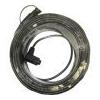
The cable connects displays from the transducer. Cable Kit Features: Product # 000-010-511 / 18, Cable Kit, Connects To Displays From The Transducer, Cable Length Available In 30m & 50m
Read more
|
|
|
| |

|
|
HXAE006R Covers:General coverage of the coasts of Indonesia east of Sulawesi, northern Papua New Guinea, and the Solomon Islands. Included in this overall general coverage are numerous detailed charts covering areas such as Ternate, Indon., Lae, ...
Read more
|
|
|


 Switch to grid view