| |
|
 |
FAP7002Processor Unit for NAVpilot 700 Series
Read more 
|
|
 |
| |
|
|
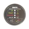
Propane Fume Detector w/Plastic Sensor & Solenoid Valve - Black Bezel DisplayDetect propane leaks early and automatically shut off gas supply to prevent personal injury and possible explosions.Features/Specifications:2-3/16" Round Black Display with...
Read more
|
|
|
| |

|
|
Xantrex Freedom HF 1000 Inverter/Charger
Read more
|
|
|
| |
|
|
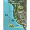
Detailed coverage of the West coast of North America from Vancouver, Can. to the U.S. border with Mexico. Detailed coverage includes Puget Sound, San Francisco Bay, San Diego Harbor, the Columbia and Snake Rivers, and the California Delta to Sacramento an
Read more
|
|
|
| |

|
|
Card Includes: Detailed Mapping Software of Calcasieu Lake, LA, including New Orleans, the Mississippi River Delta, Lake Ponchartrain and Lake Maurepas, over to Vermilion Bay
Read more
|
|
|
| |
|
|
Digital 876-SW 4ft AIS Antenna - White
Read more
|
|
|
| |

|
|
Pull up anchor and enjoy the sounds of the BOSS Audio MCKGB350B.6 Mech-less Gauge Receiver and Speaker combo kit. Included in the package are the MGR350B Receiver, one pair of MR6B Full Range 6.5 Marine Speakers and an MRANT10 Marine Dipole Antenna....
Read more
|
|
|
| |
|
|
100 watt - Gray
Read more
|
|
|
| |

|
|
Boss Audio Systems UTV4B ATV UTV Weatherproof Sound System - 4 Inch Speakers 1 Inch Tweeters Built-in Amplifier Built-in Bluetooth
Read more
|
|
|
| |

|
|
Guest on-board battery chargers have been redesigned from the inside out with the customer in mind. Our newest generation on-board marine battery chargers include leading advancements in digital charging technology and waterproof design/construction....
Read more
|
|
|
| |

|
|
25W Commercial Grade Fixed Mount VHF, Standard Horizon Part Number GX6000, NMEA2000, AIS receiver with collision alarms
Read more
|
|
|
| |

|
|
The Faria Depth Sounder offers a 199 depth capability with an automatic gain control, backlighting for maximum night vision, keel offset, and visual and audible alarms for deep and shallow water.
Read more
|
|
|


 Switch to grid view