| |
|
 |
BlueChart g2 Vision offers the same rich detailed charting of BlueChart g2 to help you get the most out of your unit. In addition, g2 Vision features a growing database of high-resolution satellite imagery, above and below the water 3D perspective, auto g
Read more 
|
|
 |
| |
|
|
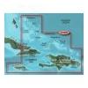
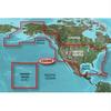
HXUS029R Covers:FEATURING DATA FROM EXPLORER CHARTS FOR THE BAHAMAS!!! Detailed coverage from Eleuthera Island, Bahamas to the Dominican Republic
Read more
|
|
|
| |
|
|
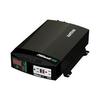
The PROwatt SW Series feature True Sine-Wave AC output with 600, 1000 and 2000 watts respectively. With high surge capability, the PROwatt SW Series provides the necessary current to startup demanding electrical loads such as variable speed power...
Read more
|
|
|
| |

|
|
Coverage of the Pacific Ocean from the Hawaiian to Mariana Islands. Includes coverage of Guam, Midway, and Johnston Atoll. General coverage of Palmyra Atoll and the Marshall Islands also included.
Read more
|
|
|
| |
|
|
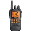
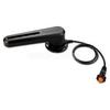
Uniden MHS75 Brand New Includes Three Year Warranty, The Uniden MHS75 is a waterproof, portable two way VHF Marine radio that delivers great performance under the most extreme weather conditions. The compact, lightweight design fits easily in your hand an
Read more
|
|
|
| |
|
|
product : garmin bluechart g2 hxus039r us g2 (entire us) microsd & manufacturer : garmin charts manufacturer part no : 010-c1018-20.
Read more
|
|
|
| |
|
|
GRF™ 10 - Rudder Feedback SensorCompatible DevicesPair this sensor with the GHP 12™ to provide rudder position feedback and to detect and avoid rudder stops while sailing or boating.The GRF 10 uses a magnetic sensor to relay position information
Read more
|
|
|
| |
|
|
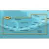
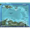
Covers the Caribbean from Haiti to Trinidad & Tobago, including Puerto Rico and all of the Lesser Antilles. Also includes the Colombian and Venezuelan coasts from Barranquilla, Colombia to the mouth of the Orinoco River, including Lake Maracaibo and the G
Read more
|
|
|
| |
|
|
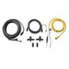
GARMIN NMEA 2000 STARTER KIT 010-11442-00
Read more
|
|
|
| |
|
|
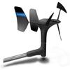
gWind™ Transducer OnlyThe gWind transducer features twin-fin technology with 3-bladed propeller for more accurate TWS in lighter air while the twin-fin design gives a more stable TWA. The 3-bladed propeller, unlike a cups design, is always efficient
Read more
|
|
|
| |
|
|
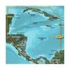
HXUS031R Covers:Detailed coverage of the northern coast of Central America from Cancun, Mexico to Barranquilla, Colombia, including the Panama Canal in its entirety. General coverage of the northern half of the Gulf of Panama. Also includes detailed...
Read more
|
|
|
| |
|
|
With Garmin''s NMEA 2000 Fluid Level Analog Adapter aboard your vessel, you can give new life to your old gauges by making the transition from analog to digital. This simple-to-install adapter takes the data generated by traditional analog gauges and conv
Read more
|
|
|


 Switch to grid view