| |
|
 |
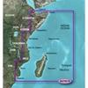
VAF001R Covers:General coverage of the east coast of Africa from the Gulf of Tadjoura to the Bay of Maputo, including Mogadishu, Som., Mombasa, Ken., and Dar es Salaam, Tan. Also inclu
Read more 
|
|
 |
| |
|
|
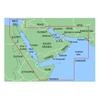
VAW005R Covers:Coverage of the Arabian Peninsula beginning at the Mediterranean Sea from Beirut to Alexandria. Coverage includes the Suez Canal, Gulf of Aqaba, and the Red Sea and Gulf of Aden in their entirety. Includes the Strait of Hormuz, Gulf of Oman
Read more
|
|
|
| |
|
|
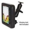
The 585-RAM-MNT is an overhead mounting solution for FCV585 and FCV620 fish finder displays. This rugged, versatile mounting system gives you the capability to mount either the FCV585 or the FCV620 from an overhead, bulkhead or just about any flat surface
Read more
|
|
|
| |
|
|
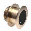
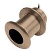
Garmin B175L Bronze 12 Degree Thru-Hull Transducer - 1kW, 8-Pin
Read more
|
|
|
| |
|
|
Cable coupler, marine network
Read more
|
|
|
| |
|
|
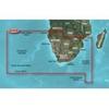
Includes detailed coverage of Durban S. Af. and Maputo, Moz. Also includes detailed coverage of the Tristan da Cunha Group, the island of St. Helena, and the Prince Edward Islands. 010-C0748-00 Garmin Vaf002R South Africa G2 Vision Sd VAF002R Covers: Deta
Read more
|
|
|
| |
|
|
HUMMINBIRD ACCESSORIES Transom Mount Transducer (Includes 20 ft. Cable & Hardware). XNT 9 DI T Single/Down Imaging, 200kHz+455/800kHz, Temp, In-Hull Mounting Epoxy.
Read more
|
|
|
| |

|
|
Garmin B175L Bronze 20 Degree Thru-Hull Transducer - 1kW, 8-Pin
Read more
|
|
|
| |

|
|
RayNet to RJ45 Male Cable - 1mRayNet network cables are for connecting the Digital Sounder Module (DSM) sonar, SR100 Sirius Weather Receiver and additional compatible Raymarine Multifunction Displays.The RayNet connector is used for connecting Raymarine n
Read more
|
|
|
| |
|
|
Garmin B75M Bronze 12 Degree Thru-Hull Transducer - 600W, 8-Pin
Read more
|
|
|
| |

|
|
S100Wireless SeaTalk autopilot remote controlS100 Wireless Autopilot RemoteCompact and lightweight, the S100 remote delivers the freedom of wireless control to any Raymarine SeaTalk autopilot
Read more
|
|
|
| |

|
|
Easily monitor your assets with this SPOT TRACE SPOT-TRACE-01 tracking device that provides text and e-mail alerts when movement is detected and lets you view the GPS coordinates of your valuables online (basic service plan required, not included).
Read more
|
|
|


 Switch to grid view